FieldX News
FieldX GeoNotes Released
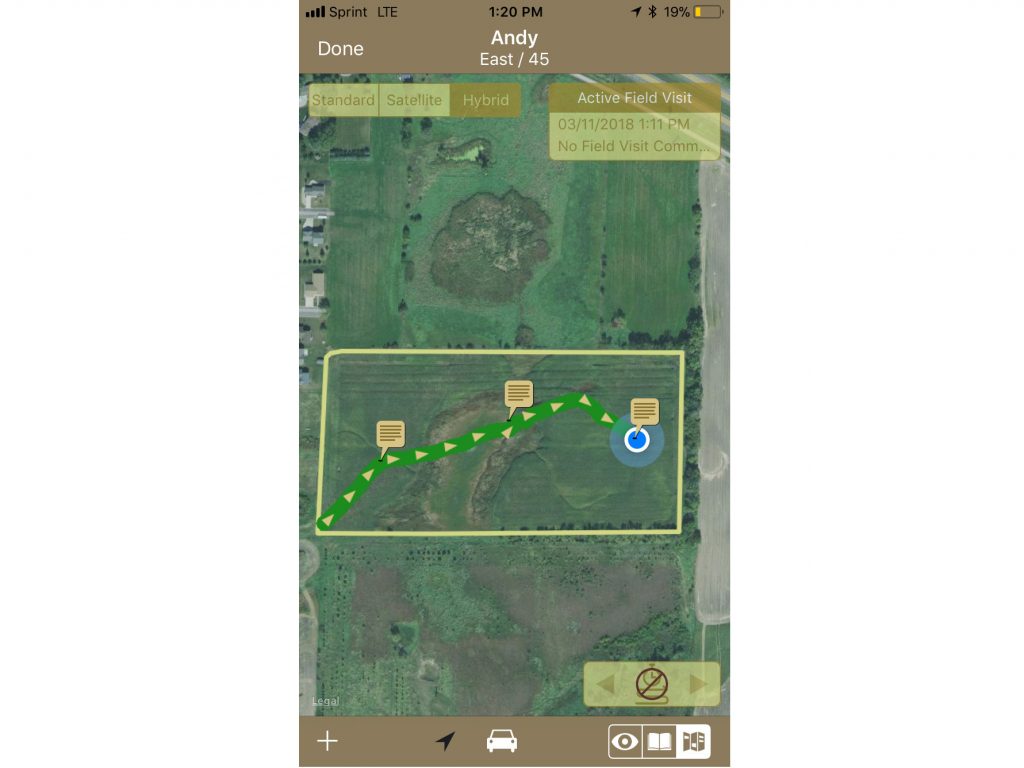
FieldX® GeoNotes™ app for taking georeferenced notes and pictures in the field from an iPhone® or iPad®. The app also records the user’s path through the field.
Below are a few examples of how the GeoNotes app can be used:
- A scout can record points to identify a specific location with a concern, or to indicate a location with an issue they are unfamiliar with.
- Record quick comments on field conditions, and take photos of crop progress on each field visit.
- Document georeferenced location of crop damage.
- Navigate to user-defined observation locations to re-check an issue in the field, or investigate potential problem areas.
- Mark locations of hazards and features in the field, such as rocks or drown-outs.
GeoNotes works online and offline, and can be synced to anyone in your organization when you are connected. Journal entries created in the GeoNotes app are currently only supported in the GeoNotes app.
Click on the following icon from your iPad or iPhone download the app:
.